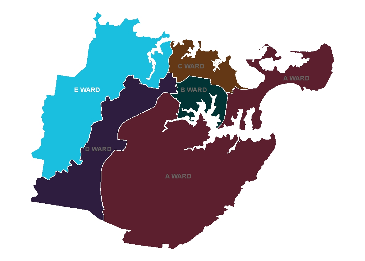
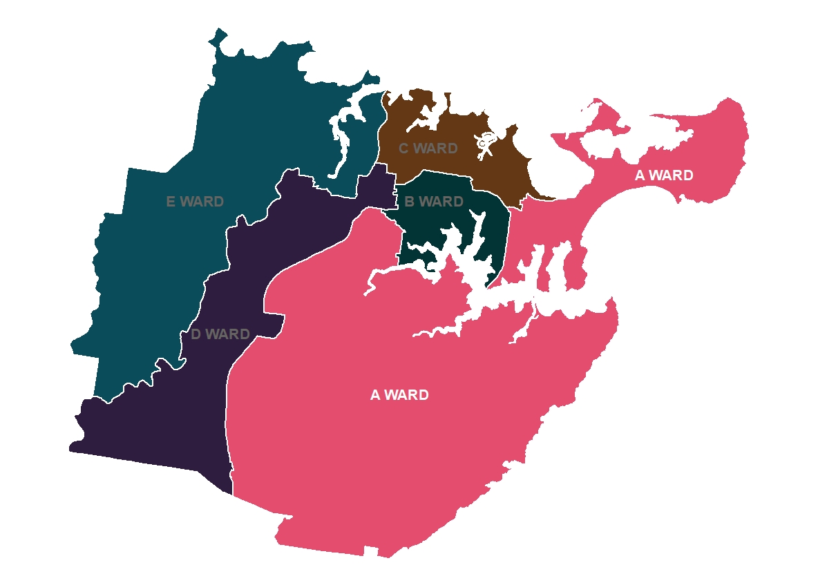
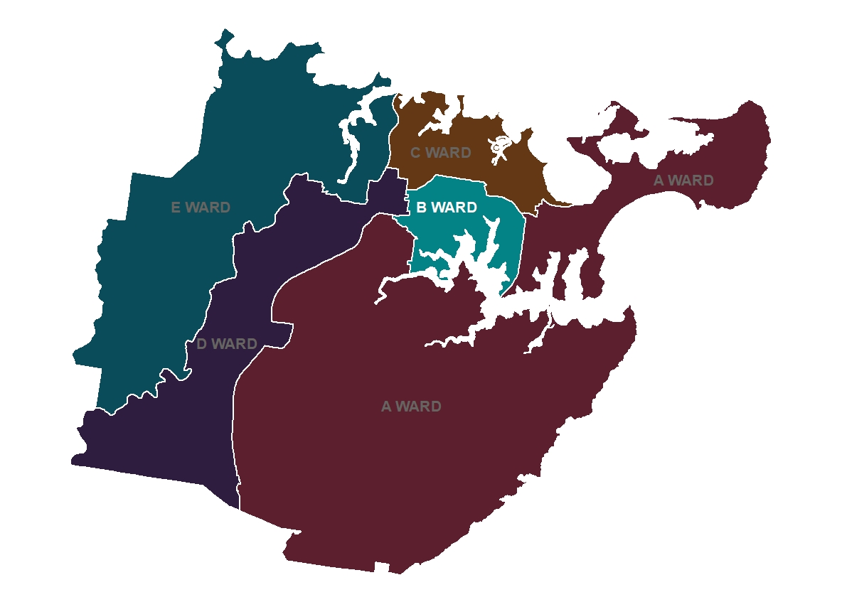
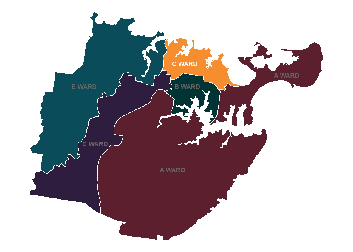
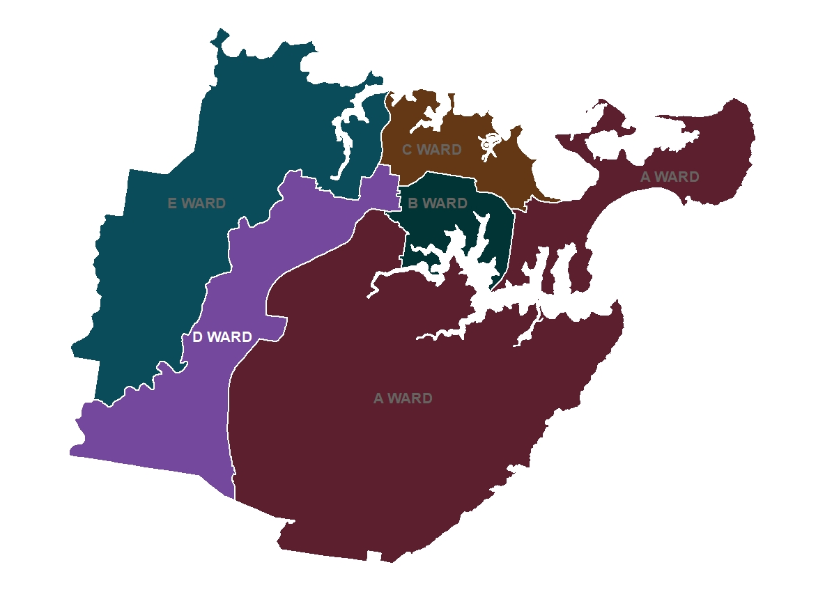
Sutherland Shire Council is made up of five wards: A, B, C, D and E, each ward represented by three publicly elected Councillors.
A Ward Councillors
- Marcelle Elzerman (Liberal)
- Kal Glanznig (Independent)
- Carol Provan (Independent)
Ward A is to the east of Sutherland Shire and is made up of the following localities:
- Bundeena
- Burraneer
- Caringbah (part of)
- Caringbah South (part of)
- Cronulla
- Dolans Bay
- Greenhills Beach
- Kurnell
- Lilli Pilli
- Maianbar
- Port Hacking
- Royal National Park (part of)
- Woolooware (part of)
B Ward Councillors
Ward B is in the central part of Sutherland Shire and is made up of the following localities:
- Caringbah (part of)
- Caringbah South (part of)
- Grays Point
- Gymea Bay
- Gymea (part of)
- Kirrawee (part of)
- Lilli Pilli
- Miranda (part of)
- Yowie Bay (part of)
C Ward Councillors
Ward C is in the central part of Sutherland Shire and is made up of the following localities:
- Caringbah (part of)
- Como (part of)
- Jannali (part of)
- Kangaroo Point
- Kareela
- Kirrawee (part of)
- Oyster Bay
- Sylvania
- Sylvania Waters
- Taren Point
D Ward Councillors
Ward D is in the western part of Sutherland Shire and is made up of the following localities:
- Engadine
- Heathcote
- Kirrawee (part of)
- Loftus
- Sutherland (part of)
- Waterfall
- Woronora Heights
- Yarrawarrah
E Ward Councillors
Ward E is in the western part of Sutherland Shire and is made up of the following localities:
- Alfords Point
- Bangor
- Barden Ridge
- Bonnet Bay
- Como (part of)
- Illawong
- Jannali (part of)
- Menai
- Sandy Point
- Sutherland (part of)
- Woronora